檔案:Xiaozhaitiankeng.jpg
Xiaozhaitiankeng.jpg (800 × 530 像素,檔案大小:94 KB,MIME 類型:image/jpeg)
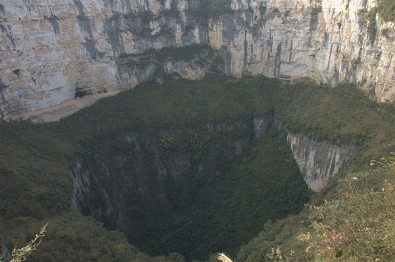
English: Xiaozhai "Tiankeng" (collapse of a river cave roof), seen from the southern rim; provincial-level municipality of Chongqing (before 1997 part of Province Sichuan). A new tourist road off Fengjie (at Yangtze River) to Xiaozhai (Little Village), leads to the world's finest tiankeng. Xiaozhai Tiankeng is 511 m deep from the lowest point of the vertical wall's rim. Its upper section is 600 m in diameter. The lower section is 300 m across, with vertical cliffs over 300 m high round its entire perimeter, except where a steep fan of collapse debris is banked against its northern wall. The tiankeng now has stone steps zigzaging down the debris fan to the floor.
Français : « Xiaozhai Tiankeng » (小寨天坑), vu depuis le Sud, situé dans la municipalité de Chongqing, situé sur la route touristique du Xian de Gengjie (au bord du fleuve Yangzi), près de Xiaozhai (小寨 « Petit village »), se situe une fosse de 511 mètres de profondeur à son plus bas point de la falaise. Sa section la plus haute à un diamètre de 600 m, tandisque la plus basse à un diamètre de 300 m, avec des falaises verticales de plus de 300 m sur l'ensemble de son périmètre extérieur, à l'exception d'une partie du mur Nord ou des restes d'un éboulis se sont formés. Cette fosse possède à présent des escaliers en zigzag sur ces éboulis, descendant jusqu'au fond. 中文: 重庆奉节小寨天坑
免费软件 http://commons.wikimedia.org/wiki/File:Xiaozhaitiankeng.jpg
檔案歷史
點選日期/時間以檢視該時間的檔案版本。
| 日期/時間 | 縮圖 | 尺寸 | 使用者 | 備註 | |
|---|---|---|---|---|---|
| 目前 | 2014年1月11日 (六) 21:17 |  | 800 × 530(94 KB) | Penarc(留言 | 貢獻) | English: Xiaozhai "Tiankeng" (collapse of a river cave roof), seen from the southern rim; provincial-level municipality of Chongqing (before 1997 part of Province Sichuan). A new tourist road off Fengjie (at Yangtze River) to Xiaozhai (Little Village),... |
無法覆蓋此檔案。
檔案用途
下列頁面有用到此檔案:
